I’m excited about the prospects of a safer Osborne Rd. For the record I am for the 3 lane conversion the most of the proposed options. If the county were to mill and overlay tomorrow, this is a great low/no cost way to drastically increase safety and accessibility.
However, I feel this particular study does not draw from other cities past experience well enough. At the study meeting it was mentioned that the city of Crystal lamented that they did not do the 3 lane option for the full length of the roadway. I see the same sort of trepidation here.
Road Speed
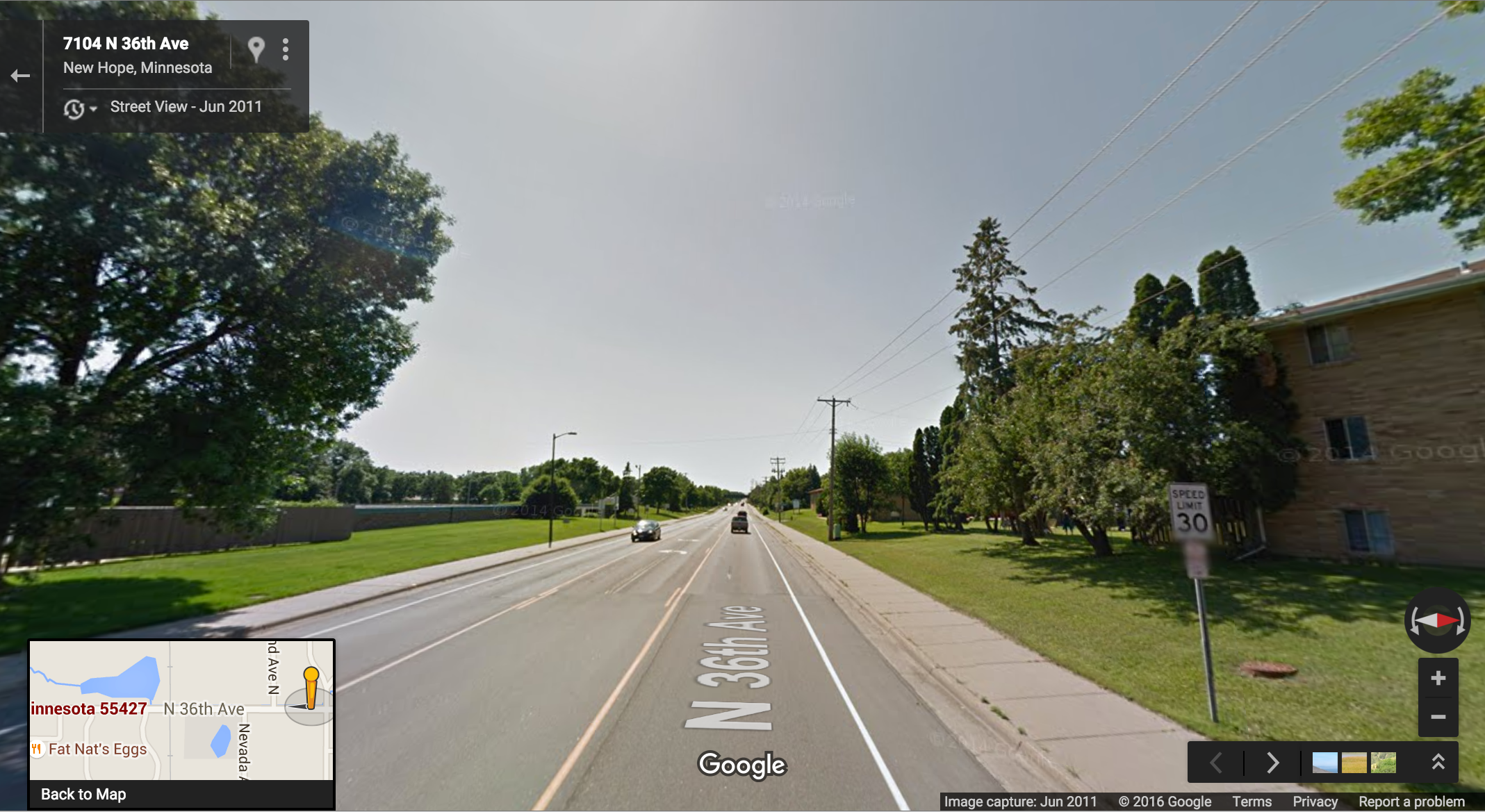
Why not lower the speed limit to 30MPH? Residents in attendance at the meeting were obviously concerned about the speed as they’re asking for more enforcement. The real answer to enforcement is self-enforcement and the road diet would provide that. But why not lower the speed limit to 30? The odds of a pedestrian fatality at 40MPH is two times of that at 30MPH – and lets face it, travelers on a 35MPH road are going to be driving 40MPH.
I’m disappointed that the road starts with double-wide lanes at MN-47 and MN-65. I understand this is to accommodate the double left turn lanes from those roads onto Osborne. The real solution would be to reduce those to a single left turn lane and decrease the cycle time on those traffic signals so the single left turn lane does not back up. I realize this is MnDOT territory, and not likely to change.
Different East/West Treatment
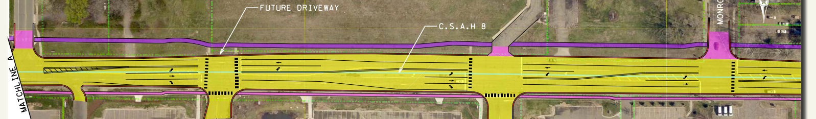
The proposed treatment of the western side of Osborne is very different from the (preferred) treatment on the east side of Osborne.
West
vs.
East
Rather than creating a left turn lane(s) into lots that don’t yet exist, just use the 3-lane treatment for the entire roadway. Better to have a flexible system that accommodates existing users (like bicyclists) rather than reserving roadway such as dedicated left turn lanes for future development that doesn’t exist today.
More planters and crosswalks
For a consistent driver experience, and a much friendlier pedestrian experience, I’d suggest duplicating the planter option on all offset Fridley/Spring Lake Park cross-streets:
Adding more crosswalks and medians (stuff in the road) will help let drivers know that this is a complex environment with students, kids on bikes, emergency vehicles, hospital visitors, cyclists, pedestrians – all of which gives a clear indication to drivers that they should not be speeding through.
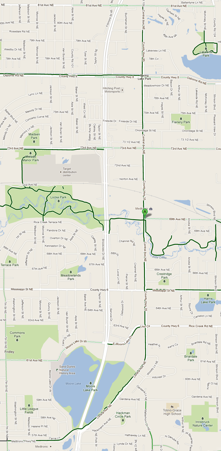
In Christopher Alexander’s A Pattern Language, he explains how raised paths literally elevate its users to a status above the automobile. I suggest doing this for the entirety of the trail along Old Central Avenue, from it’s split from MN-65 on the south end to 81st Ave. NE on the north. It is an important bicycling and pedestrian connection that is also serviced by Route 10.
It would not require any changes in existing traffic controls – there is only one traffic signal on this route (seen at map marker “A”):
Since this signalized intersection is at a T it really bears no relevance, the trail is not intersected by the road. All of the other intersections are 4-way stops. A raised path would provide smooth passage for bikers & walkers, with their newly elevated status. At intersections, the raised path would remain as the crosswalk, effectively becoming a giant speed-bump to calm traffic and make people more aware of pedestrians. Similar to these types of raised “zebra” crossings:
Raised Zebra Crossing
For cyclists, gone would be up-and-down whoops of the endless curb cuts. A smooth, straight ride to bring you down the road. This also is a benefit for people in wheelchairs or scooters, as the ADA recommends a straight of a path as possible.
I don’t expect something like this would happen right away, but it should at least be on the city’s radar for when the path is repaved.
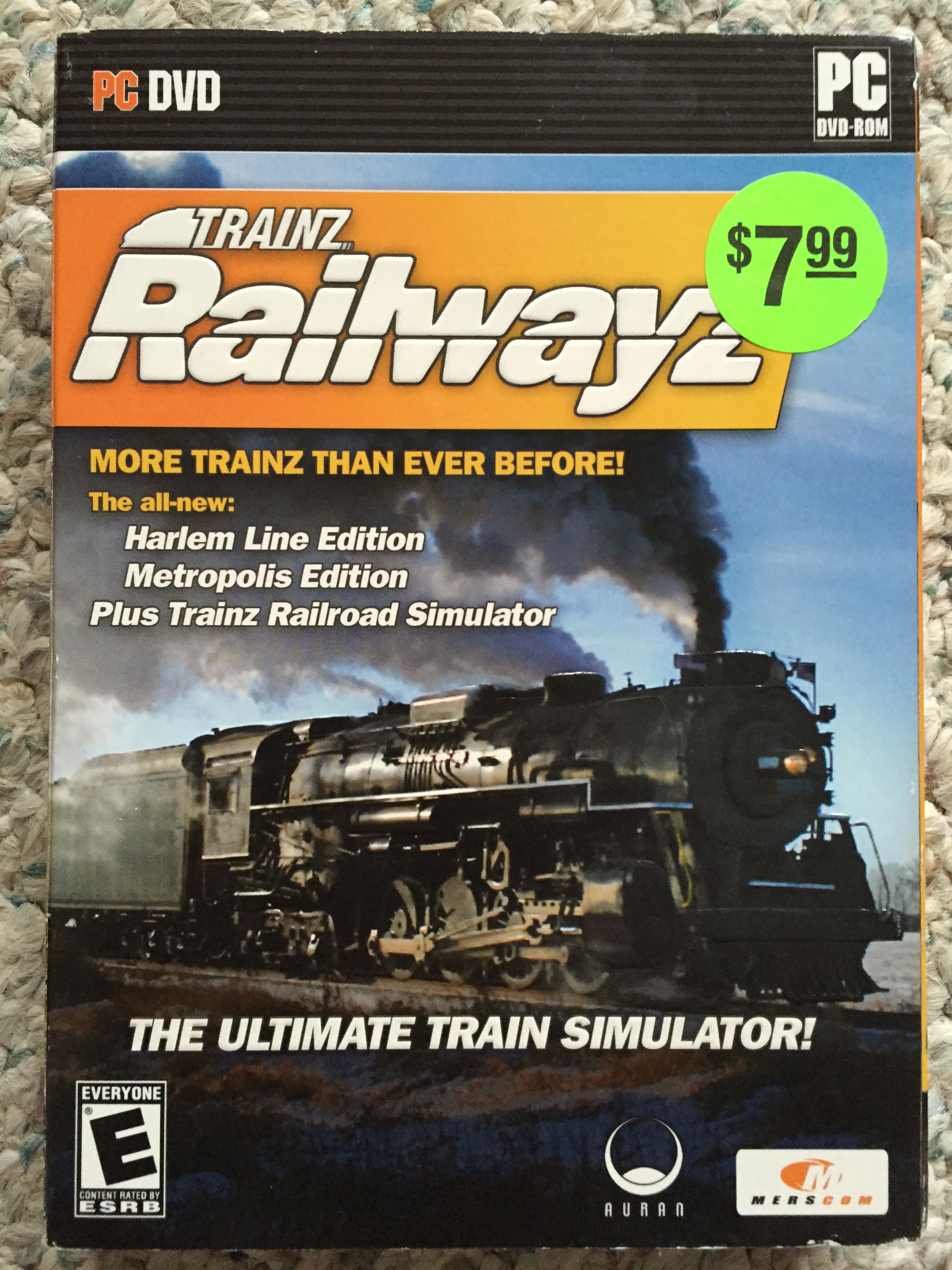
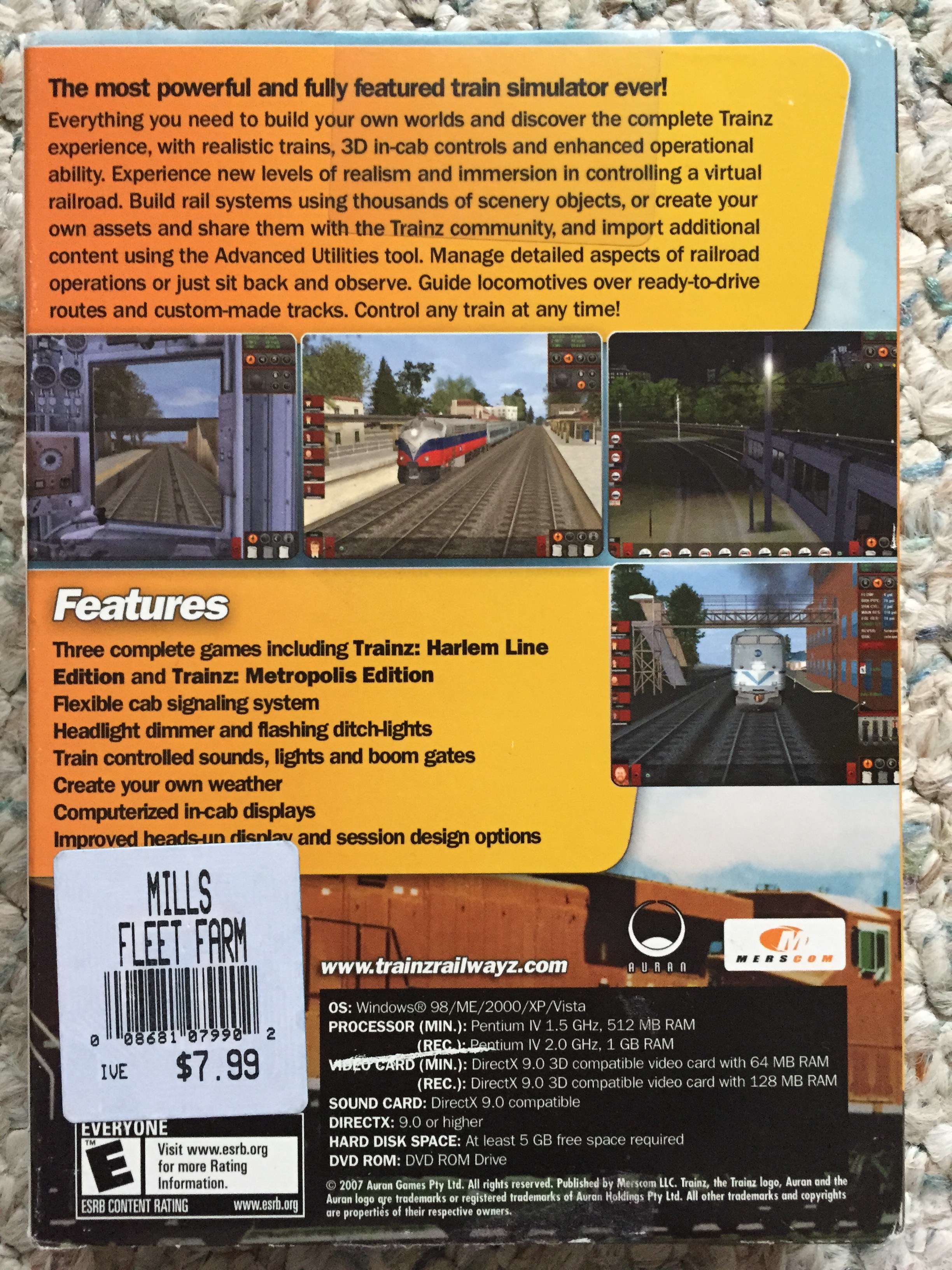
My son Jules loves trains. I like trains too and my enthusiasm was probably the seed that grew into his obsession. My good friend Joe bought Jules a copy of “Trainz Railroad Simulator” for Christmas a year ago. It was in the bargain bin at Mills Fleet Farm:
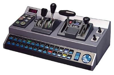
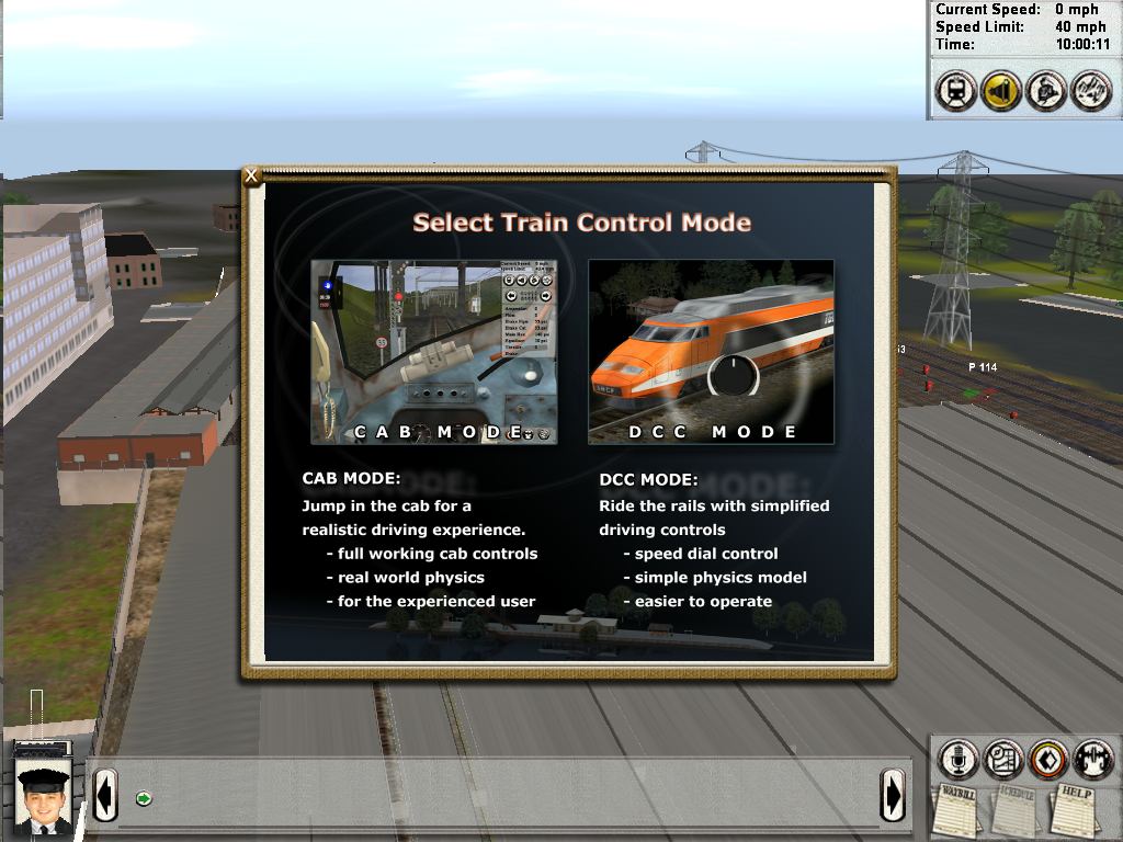
Still at $180, I wasn’t about to buy the Train Cab Controller, which would certainly make the game infinitely more complex for a 5 year old. Trainz has a “DCC mode” which allows you to control the trains very simply like they are model trains: with a dial.
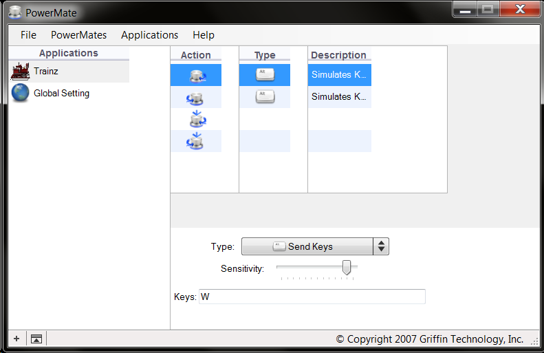
When it arrived, I downloaded and installed their driver software. It renders terribly in Windows 7 (it was probably last updated for Windows XP):
The “click” and “long click” actions are hidden in the interface (you can only see 4 at a time). But they’re there, you just need to highlight an action, and arrow down until you get to others.
For the Trainz Simulator setup, I added the following settings:
Rotate Right: Send Key – W (forward)
Rotate Left: Send Key – X (reverse)
These keys control the forward/reverse dial in the game. I set the sensitivity fairly high (see screenshot) so a turn of the Powermate would closely match what you saw onscreen.
Click: Send Key – S (stop)
Long Click: Send Key – A (apply brake)
“S” stops the train by putting the dial immediately back to zero, so a quick click is an easy way to stop. Trains are heavy though and the “A” key normally applies the brake, so I added a long click action to apply the brake – I like to think of the long click like pressing the brake pedal in a car.
Enjoy
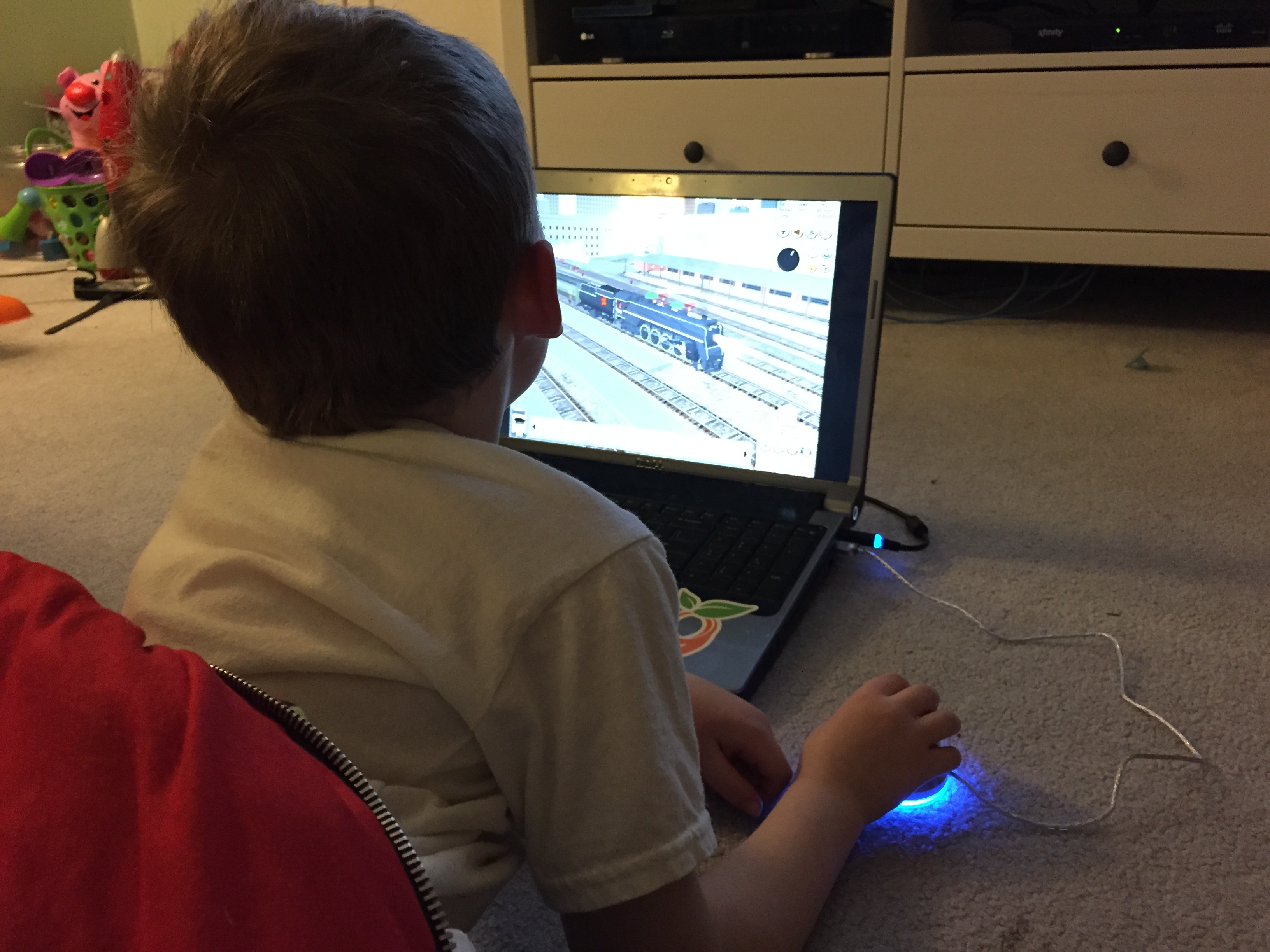
It works exactly as I imagined: simple! You can see the “dial” on the screen and the Powermate glowing under Jules’ hand that now controls it. Easy peasy.
Both the Griffin Powermate and Trainz Simulator (newer versions) are available for Mac OSX so Apple loving trainiacs won’t be left out.
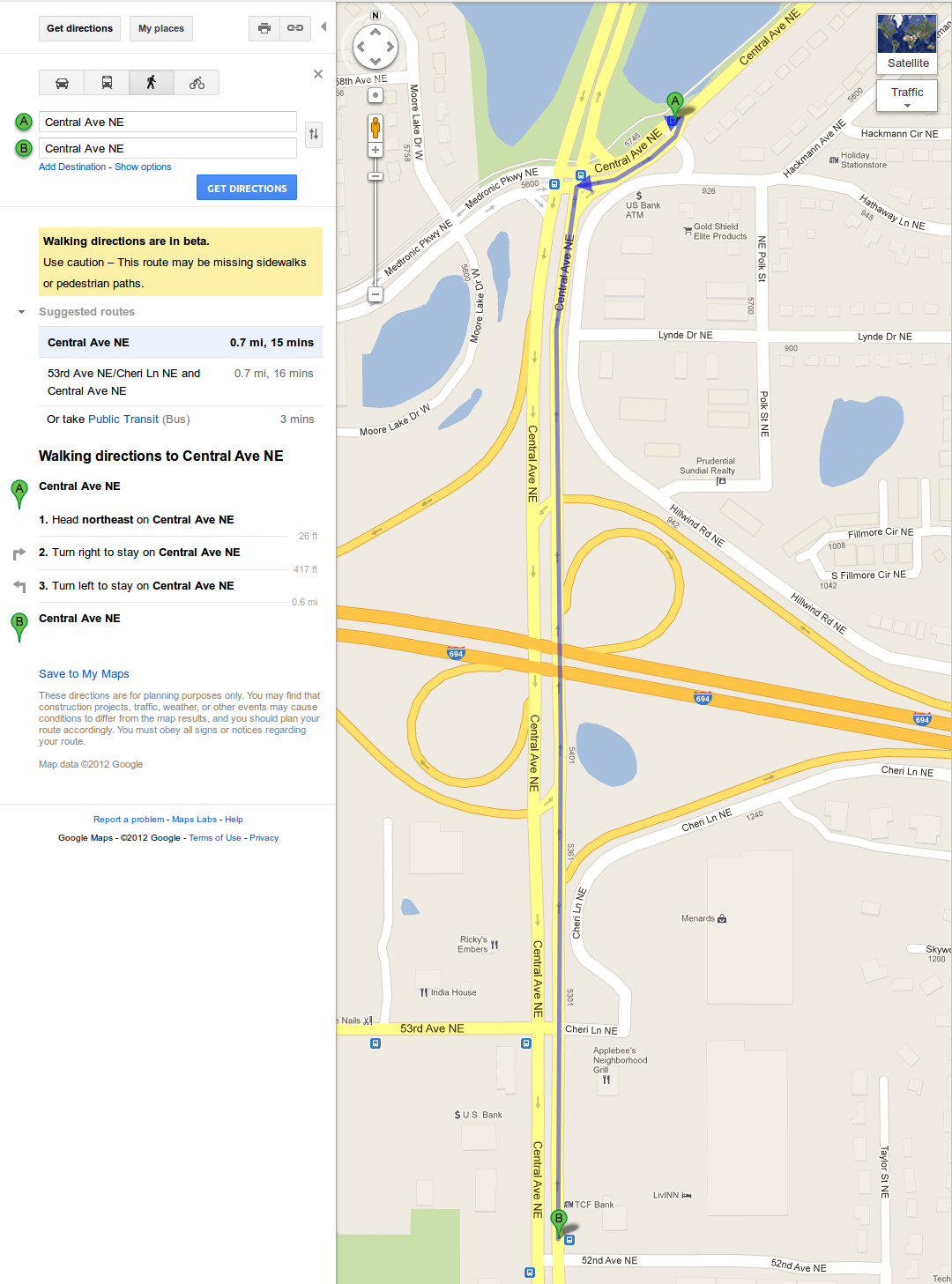
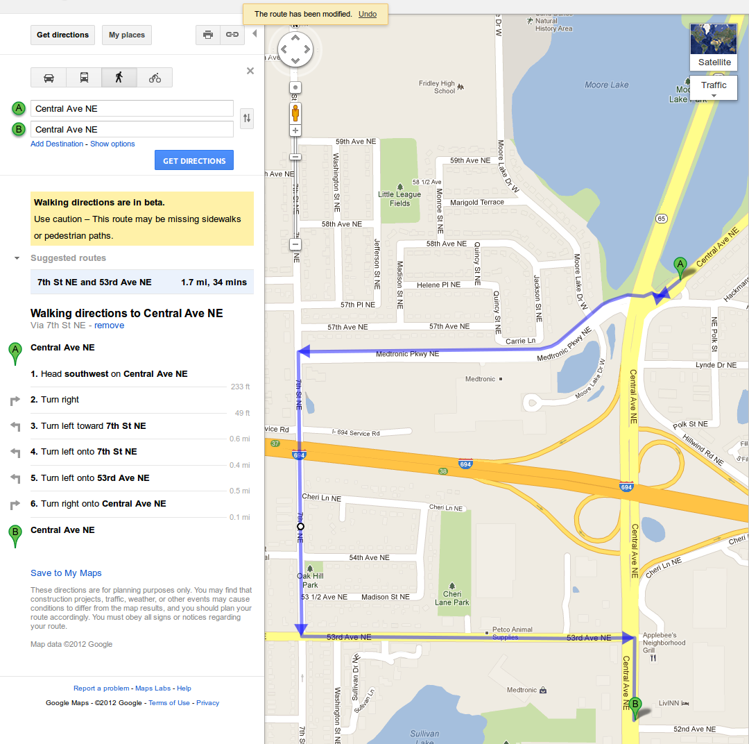
Let’s say for a moment you’re a passenger on MetroTransit’s 10N northbound. You meant to get off at 52nd & Central because you work at one of the retailers near 53rd and Central, but you missed your stop. The next stop is just north of 694, at Central & Hackmann, by the Holiday Station. The fastest way to get back would be to walk south on Central.
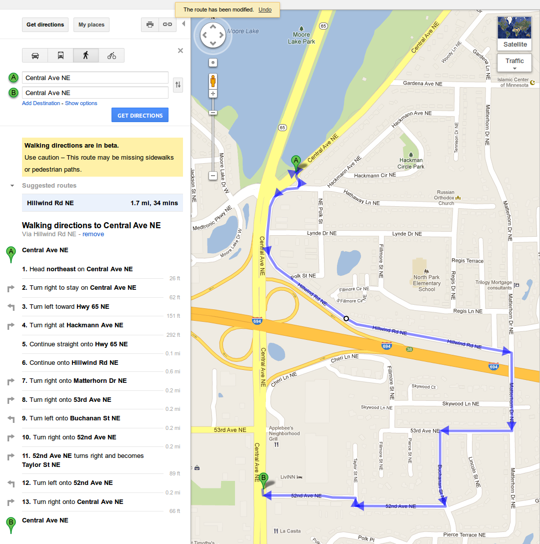
However MnDOT (as much as they love the automobile) have forbidden pedestrians on Central Ave. between 53rd and Medtronic Pkwy. (where the 694 interchange resides). There are posted “no pedestrian” signs as well as no sidewalks anywhere in the area. So legally the shortest route for pedestrians is to cross 694 using the Matterhorn bridge, adding a full mile to the trip: Continue reading →
Or you can take the equally long route under 694 via 7th St.
Of course people are just going to walk down Central Ave. You can see the “desire paths” worn into the grass. I often see pedestrians heading south on this path to go to work, or carrying grocery bags while going north, to head home.
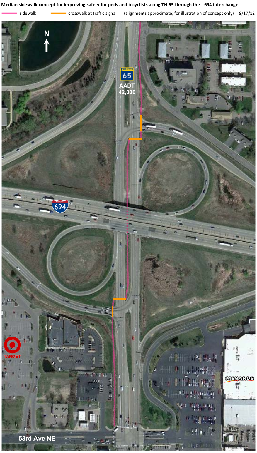
MnDOT’s solution, still part of the problem
To alleviate the problem, MnDOT has requested that some pedestrian facilities be added to this intersection during the next maintenance period. Engineers, as by-the-books as they are, came up with this:
Getting through this intersection is not meant to be a walk in the park. People who use this intersection wish to cross it as quickly as possible. The MnDOT design does make pedestrians cross at already signaled intersections, but it’s too complicated. Pedestrians are expected to wait for four (4) walk signals, and during the process they’ll wind up on the other side of Central Ave. I think at best, 50% of the people that cross this intersection are going to use the MnDOT facilities. The other 50% are going to continue on the east side as they always have.
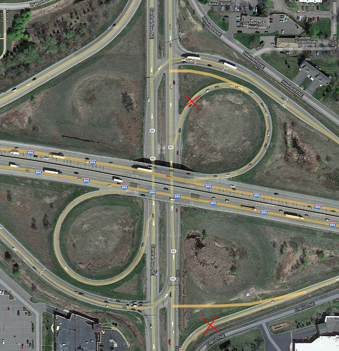
An actual permanent fix for this wouldn’t come cheap. A while back I brought up the issue on Strong Towns. The best option (in my opinion) was the one suggested by Jeffrey Jakucyk:
It simply changes the on ramps on northbound Central Ave./MN-65 into 90-degree right turns. It will make drivers slow down to turn and also puts pedestrians in their immediate view. Besides, uninterrupted on-ramps (despite what engineers think) are not a God given right.
I have the privilege of living walking distance from a bus route that has served me well for most of my time spent in the Twin Cities: The 10. When I was a kid growing up in Northeast Minneapolis, my dad would take me to Twins games downtown on the 10. Now in Fridley, I can still take it to any number of businesses along Central Ave. I can also head downtown and make any number of connections. The 10 runs late into the night, so I can even take it home after a long night of imbibing.
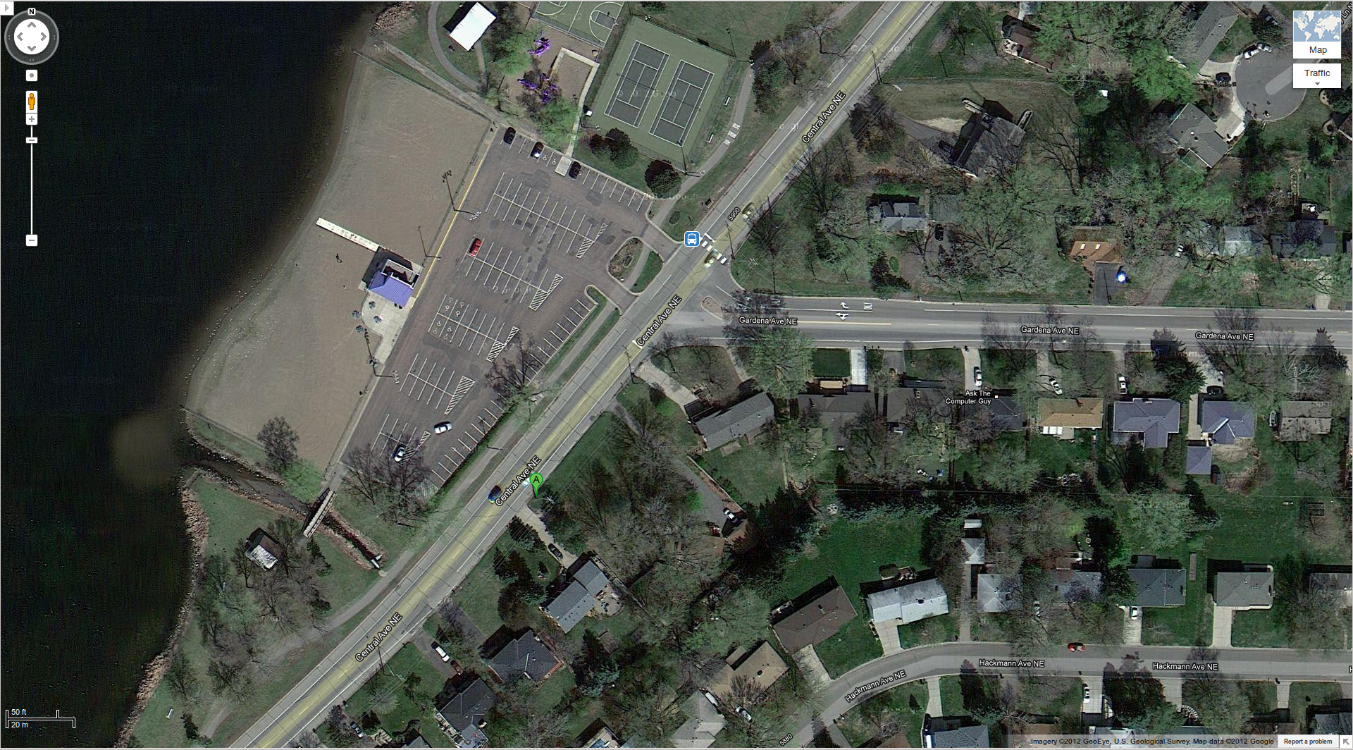
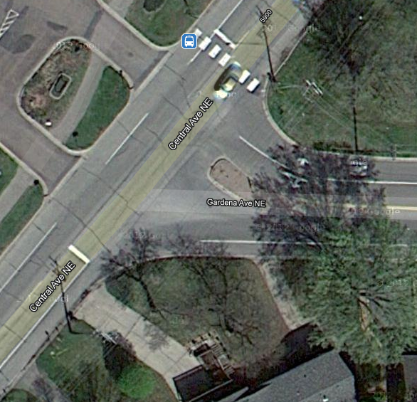
However, my closest bus stop (Central Ave. & Gardena Ave. by Moore Lake Beach) is a pedestrian SNAFU, no thanks in part to Fridley’s city planners.
You’d think that with an elementary school & high school just 2 blocks to the east of this intersection, the city would have provided a safe walking path down to the beach at Moore Lake Park – not the case.
If you are walking down Gardena Ave. (westbound), you must walk in the turn lane before getting to the crosswalk. Not exactly fun if you have a baby in a stroller or if you value your own life.
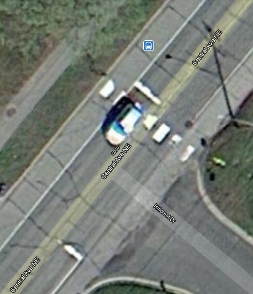
There is an additional problem for 10N passengers if they wish to disembark at this intersection. The northbound 10N’s stop is actually just before Gardena Ave. (map marker “A”). This is actually in a turn lane on Central Ave. for cars going eastbound on Gardena Ave. Pedestrians also wishing to go eastbound on Gardena Ave. can either walk in the yards (no sidewalk is provided) or walk in the turn lane. In the winter, walking in the turn lane is really the only option. Good luck when it’s dark out, it will be like a real-life game of Frogger.
I’m not asking the city to add sidewalks – I don’t think that battle can be won at this time. I’m just asking for pedestrians and cyclist to be given some respect. This intersection has far too much automotive treatment.
Replace right turn lanes with normal shoulder treatment
Removing the right turns lanes would solve a lot. Just leave the shoulders painted normally all the way up to the intersection so that cars turning right understand that this is “shared space” and that they are not the priority. A good example of this would be the intersection just to the north at Central Ave. & Hillcrest Dr.:
It’s paint, not rocket surgery
I would remove the right turn lane on Old Central Ave. to Gardena Ave. All you need to do is “erase” the turnout line on the road to reconnect it as a normal shoulder line, and then remove the right turn signs. Residents can put their garbage cans in the street on trash day and pedestrians and cyclists can use the space without fear that they’ll be hit from behind. A side benefit will be that speeding cars will be self-regulated by cars slowing to turn right.
On Gardena Ave. I would also remove the explicit right turn lane and restore normal shoulder painting. Remove the “Straight & Left” arrow from the lane as well and let drivers figure out where they should be going – keeping drivers on their toes will make them more cautious, creating a safer environment for everyone.