Once the BNSF railroad passes over the south side of I-694 and expands into the vast Northtown Yard, you have but one option to cross it in Fridley City limits: the 44th Ave. Bridge.
I always had assumed that this bridge is in Columbia Heights, but it lies in Fridley proper. The notion sunk in when I saw a Fridley Police car staking out the bridge – presumably looking for speeders.
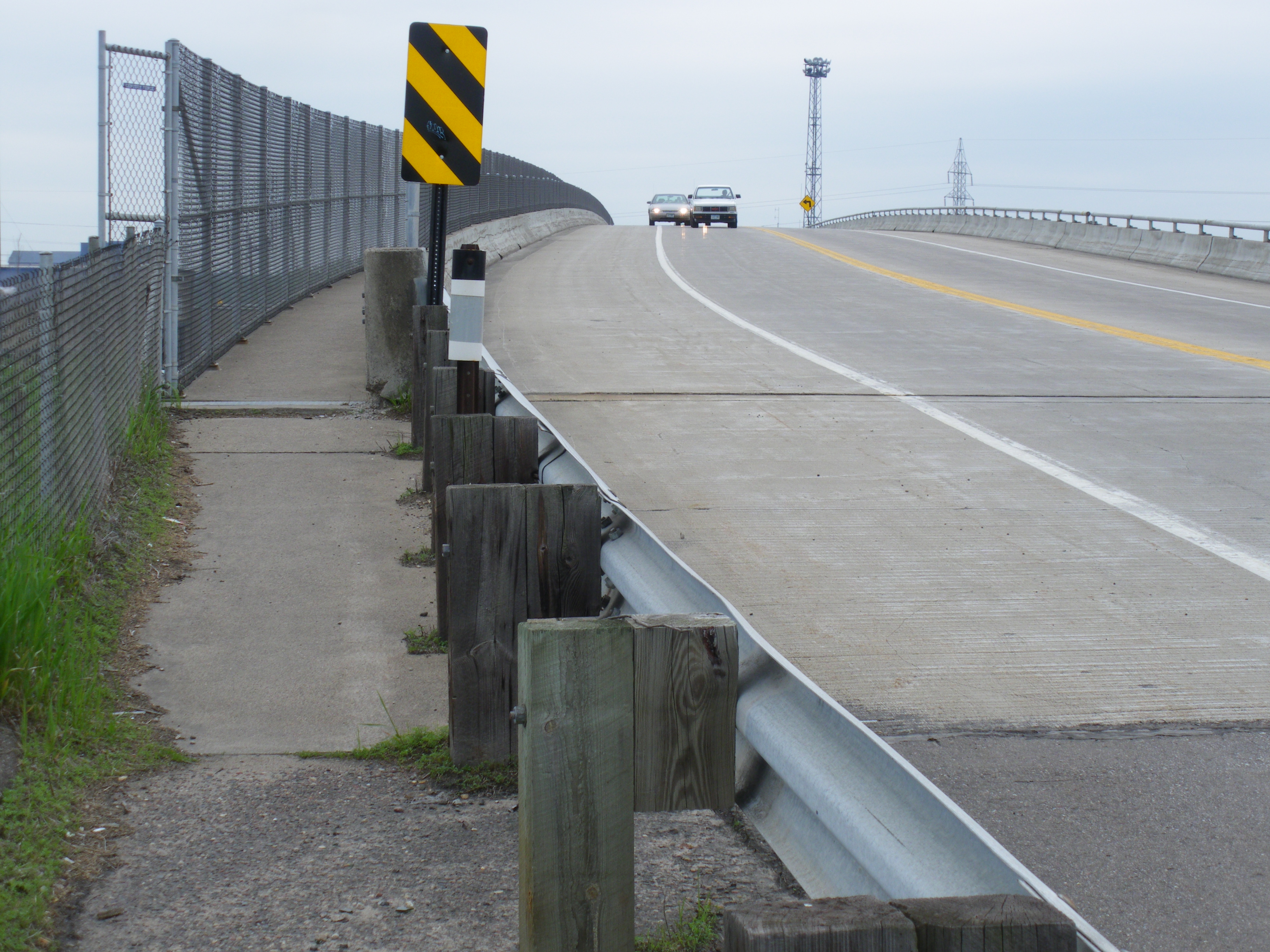
And speed they will. This bridge has a 2-lane road with extra wide lanes and extra wide shoulders. The speed limit is 30 MPH. Who are we kidding? No one is going to go 30 on it because it is engineered like a 45 MPH road:
Impatient driver, wanting to go faster than 30 MPH
The view from the top of the bridge is actually quite fascinating. You can see the “hump” at the Northtown Yard in action. A train backs up slowly to a hill (the hump) and one-by-one cars are uncoupled and roll down the other side, switching to various tracks so the non-unit train cars get rearranged to move on to their next destination:
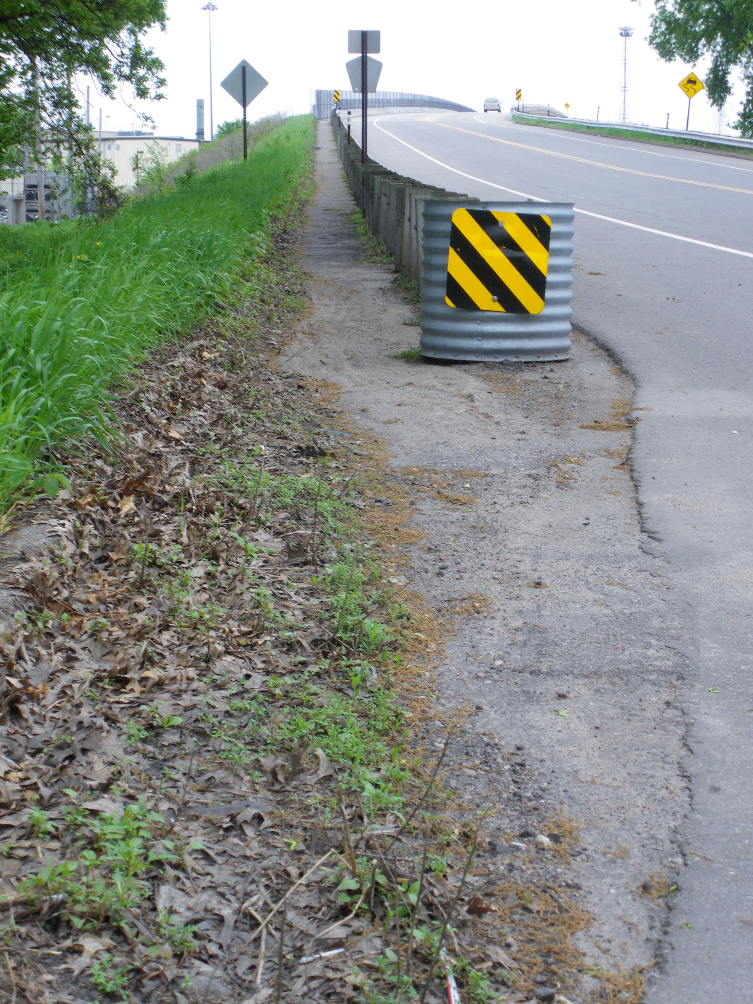
Getting up to the top of this bridge is the laughable part. There’s no real entrance to the bridge walkway from the road on the east side. There’s just a narrow, weedy, sandy, decaying section of asphalt that says “trouble” more than “walk this way:”
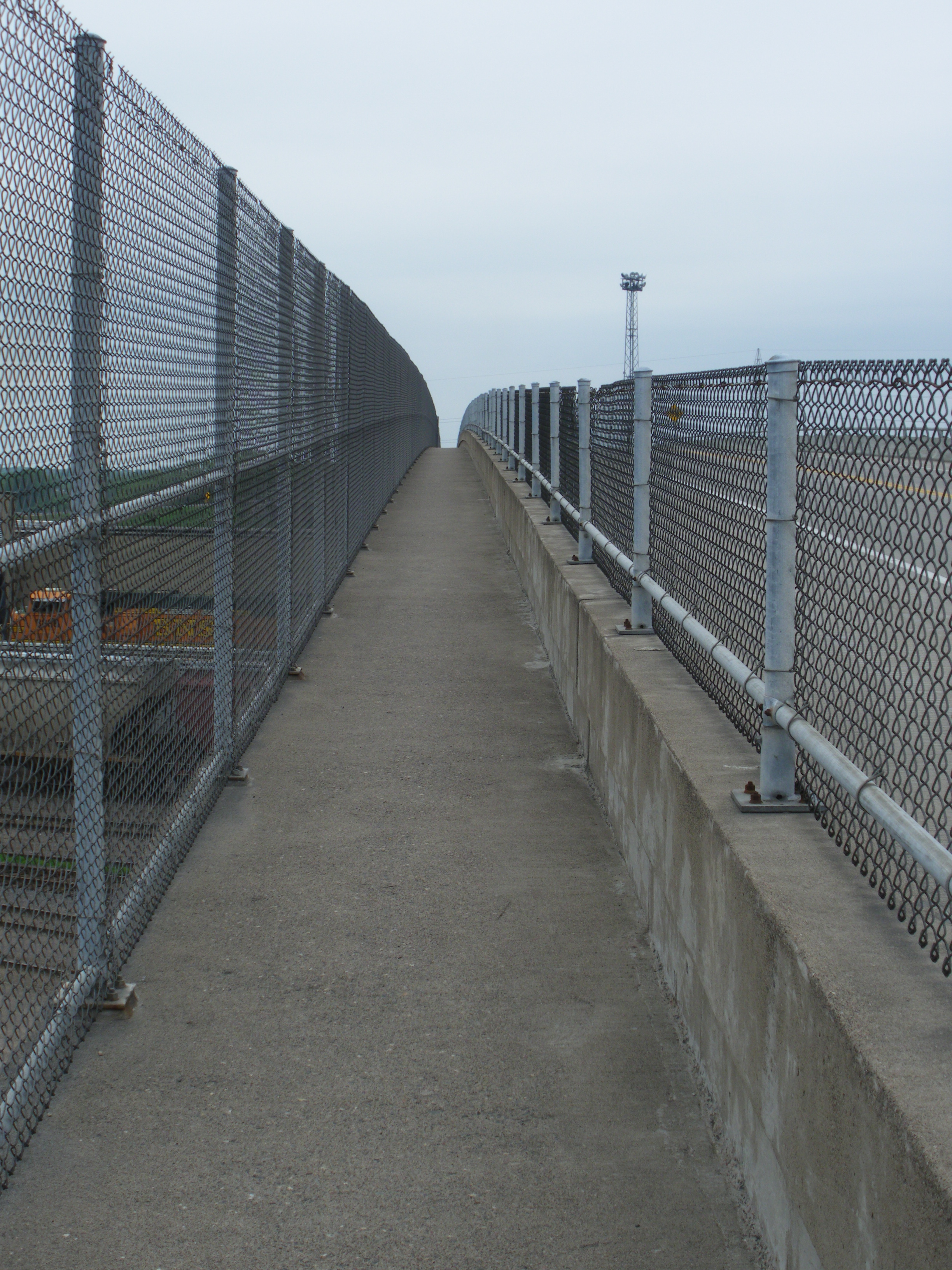
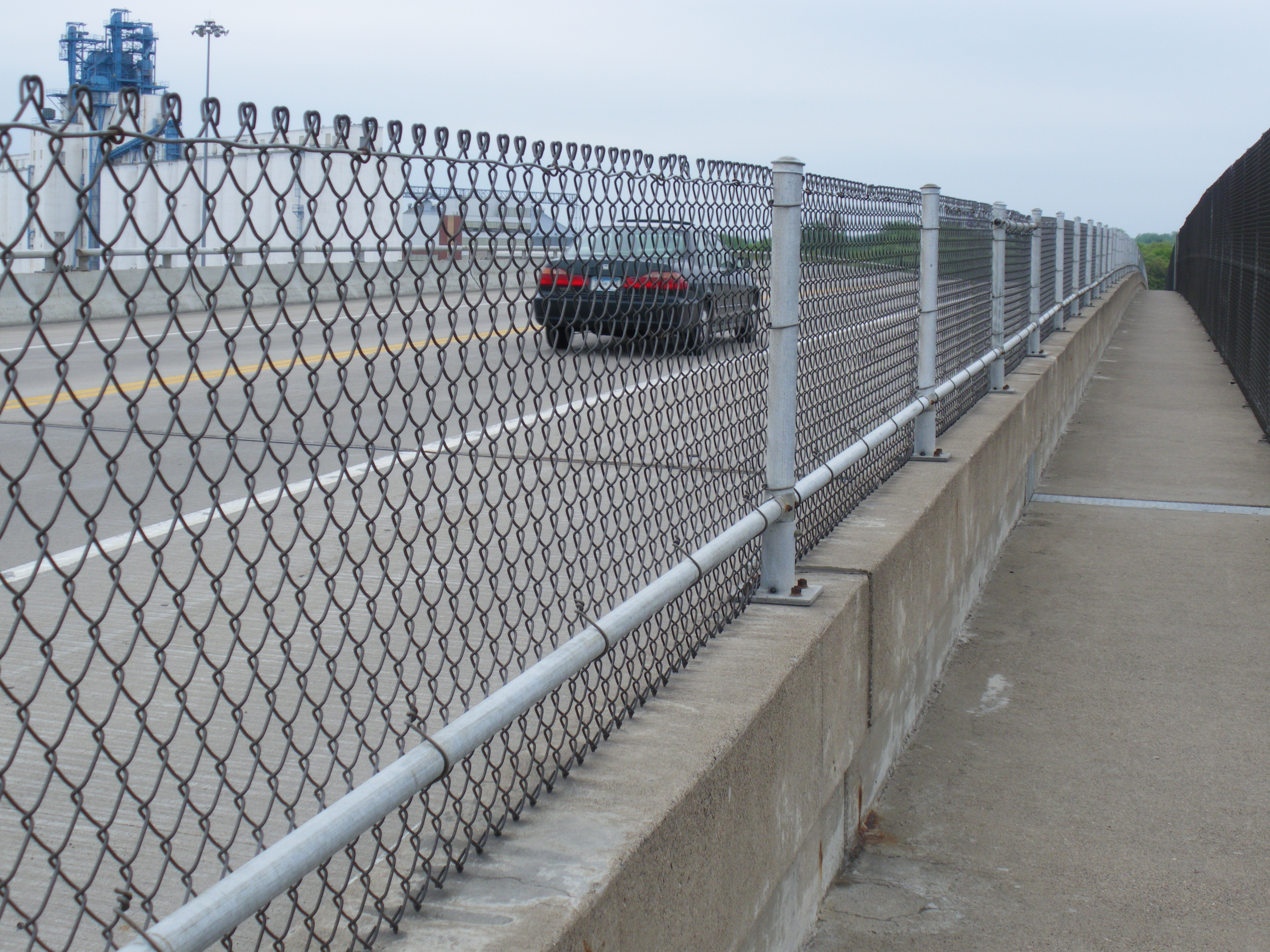
The path is perilously narrow, squeezed down by the guard rail. Once you get to the bridge it turns to concrete and doesn’t get any wider. In fact it feels narrower since you’re now encased between a fence and a jersey barrier:
I think it would be impossible for two pedestrians to pass without brushing shoulders. Yet automobiles on this bridge are given a extra-wide berth for their whopping 30 MPH:
This bridge is technically a county road (Anoka County Road 2). I understand that the county (and state) sometimes operate with heavy hands. But regardless of who assumes ownership, someone should be ashamed of themselves.
The next time this bridge is resurfaced, the lanes should be narrowed to 10 or 11 feet, to fully reflect it’s 30 MPH speed limit, and the shoulders should be even narrower yet. Then the pedestrian area could be widened to provide actual space for non-motorized traffic to travel in both directions simultaneously without the certainty of a head-on collision which is guaranteed today.
As part of Bike/Walk Week Twin Cities, I’m organizing an evening ride on the Mississippi River Trail in Fridley. This trail advertises “10 states, 1 river” as it goes from the Mississippi headwaters at Lake Itasca near Bemidji, Minnesota all the way down to the Mississippi delta and the Gulf of Mexico in Louisiana.
It will be a family friendly, leisurely ride. I will probably have my 3 year-old son in tow. The grade is pretty easy the whole way, minus some short dips down to the water line and back.
We’ll leave from Fridley Station on the west side by East River Rd. & 61st Ave. If it’s more convenient for you to arrive on the east side by University Ave. & 61st Ave., don’t fret! There’s a convenient underground pedestrian tunnel that goes under the railroad tracks between the east and west parking lots.
We’ll head out promptly at 6PM and go south along the MRT towards the Minneapolis Water Treatment Plant. Riders can turn around at any time if they’d like to ride less than 5 miles as the first part of our ride is simply out-and-back.
Then we’ll head back to Fridley Station to complete the 5 mile route, so those riders disembark. For those who want to continue on the 10 mile loop, we’ll continue north on the MRT.
We’ll turn west on Osborne Rd. and maybe stop for an ice cream cone. Then it will be south on University until we hook up with the Rice Creek West Regional trail which will bring us back where we started.
Update
We had a good turnout of 10 riders for the first (annual?) Fridley Bike Tour.
Riders had questions about certain landmarks which I wasn’t fully prepared to answer at the time, but I thought I’d cover them after-the-fact.
Instead of following the Mississippi River Trail up East River Road to Osborne, our riders opted to ride the more scenic & secluded Rice Creek Trail. You can see our actual route from our GPS track.
Let me know what you thought and hopefully we can make this recurring event!
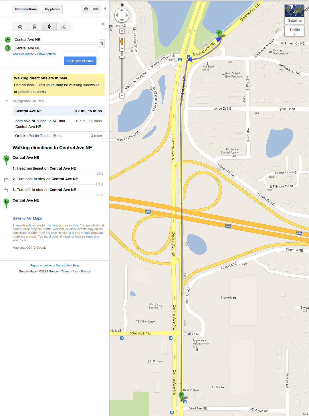
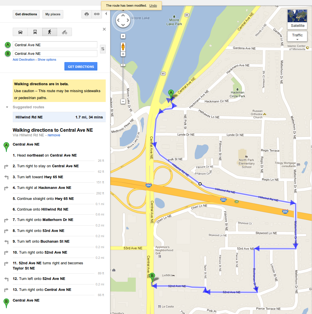
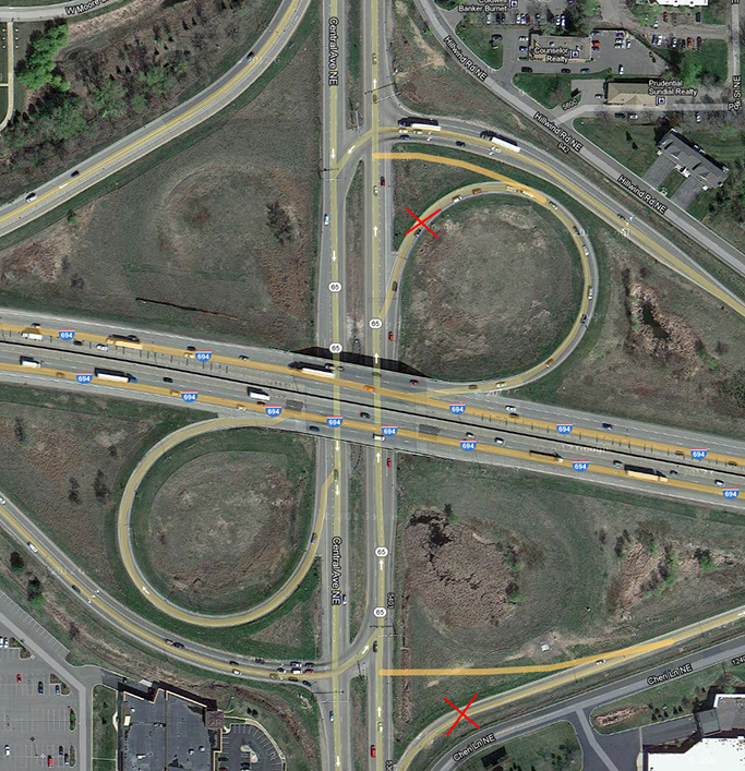
Let’s say for a moment you’re a passenger on MetroTransit’s 10N northbound. You meant to get off at 52nd & Central because you work at one of the retailers near 53rd and Central, but you missed your stop. The next stop is just north of 694, at Central & Hackmann, by the Holiday Station. The fastest way to get back would be to walk south on Central.
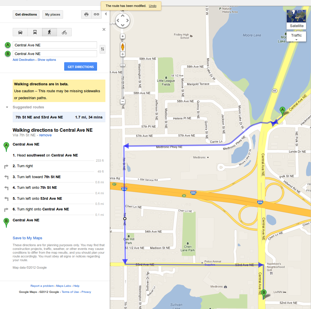
However MnDOT (as much as they love the automobile) have forbidden pedestrians on Central Ave. between 53rd and Medtronic Pkwy. (where the 694 interchange resides). There are posted “no pedestrian” signs as well as no sidewalks anywhere in the area. So legally the shortest route for pedestrians is to cross 694 using the Matterhorn bridge, adding a full mile to the trip: Continue reading →
Or you can take the equally long route under 694 via 7th St.
Of course people are just going to walk down Central Ave. You can see the “desire paths” worn into the grass. I often see pedestrians heading south on this path to go to work, or carrying grocery bags while going north, to head home.
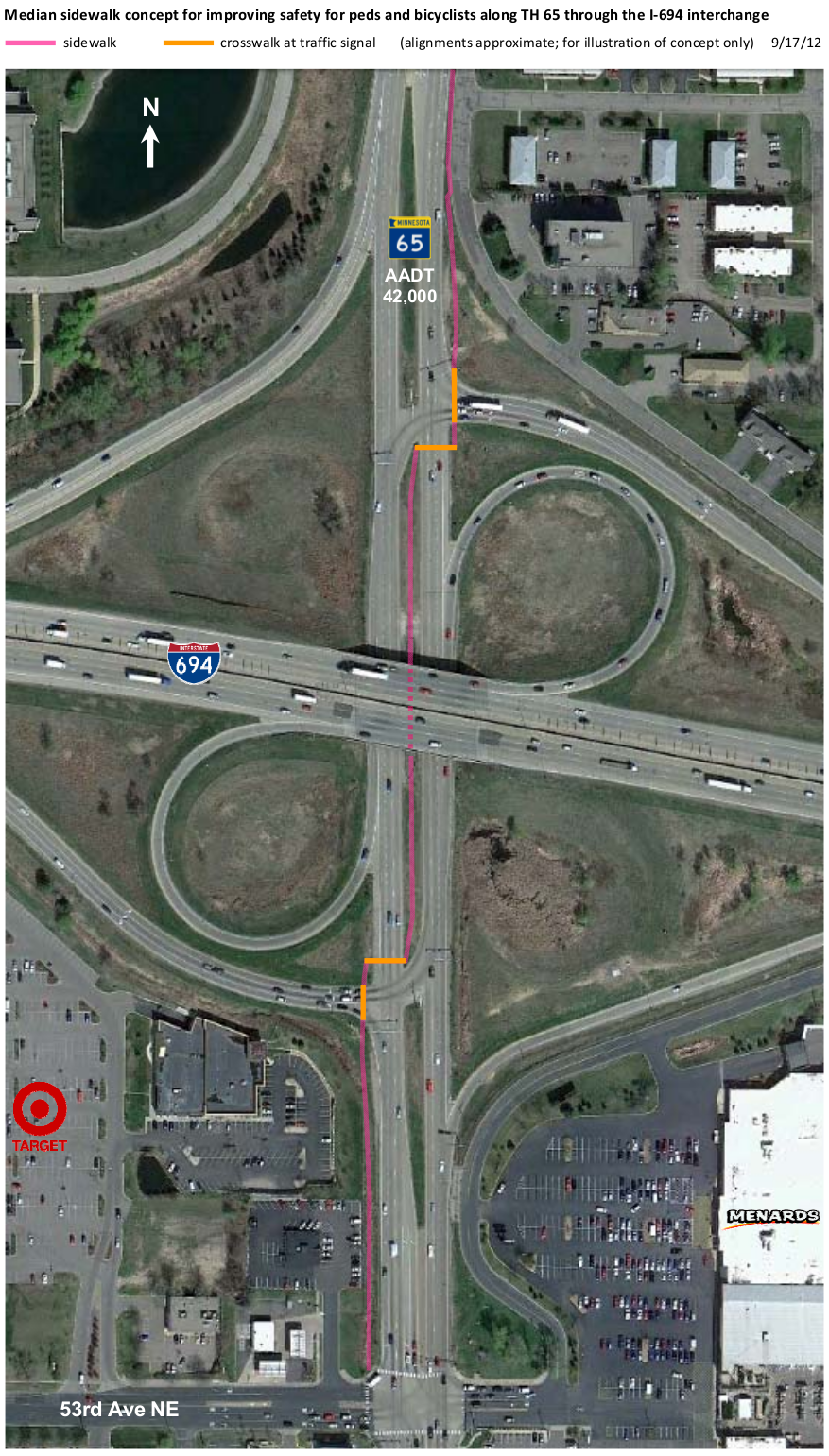
MnDOT’s solution, still part of the problem
To alleviate the problem, MnDOT has requested that some pedestrian facilities be added to this intersection during the next maintenance period. Engineers, as by-the-books as they are, came up with this:
Getting through this intersection is not meant to be a walk in the park. People who use this intersection wish to cross it as quickly as possible. The MnDOT design does make pedestrians cross at already signaled intersections, but it’s too complicated. Pedestrians are expected to wait for four (4) walk signals, and during the process they’ll wind up on the other side of Central Ave. I think at best, 50% of the people that cross this intersection are going to use the MnDOT facilities. The other 50% are going to continue on the east side as they always have.
An actual permanent fix for this wouldn’t come cheap. A while back I brought up the issue on Strong Towns. The best option (in my opinion) was the one suggested by Jeffrey Jakucyk:
It simply changes the on ramps on northbound Central Ave./MN-65 into 90-degree right turns. It will make drivers slow down to turn and also puts pedestrians in their immediate view. Besides, uninterrupted on-ramps (despite what engineers think) are not a God given right.
I have the privilege of living walking distance from a bus route that has served me well for most of my time spent in the Twin Cities: The 10. When I was a kid growing up in Northeast Minneapolis, my dad would take me to Twins games downtown on the 10. Now in Fridley, I can still take it to any number of businesses along Central Ave. I can also head downtown and make any number of connections. The 10 runs late into the night, so I can even take it home after a long night of imbibing.
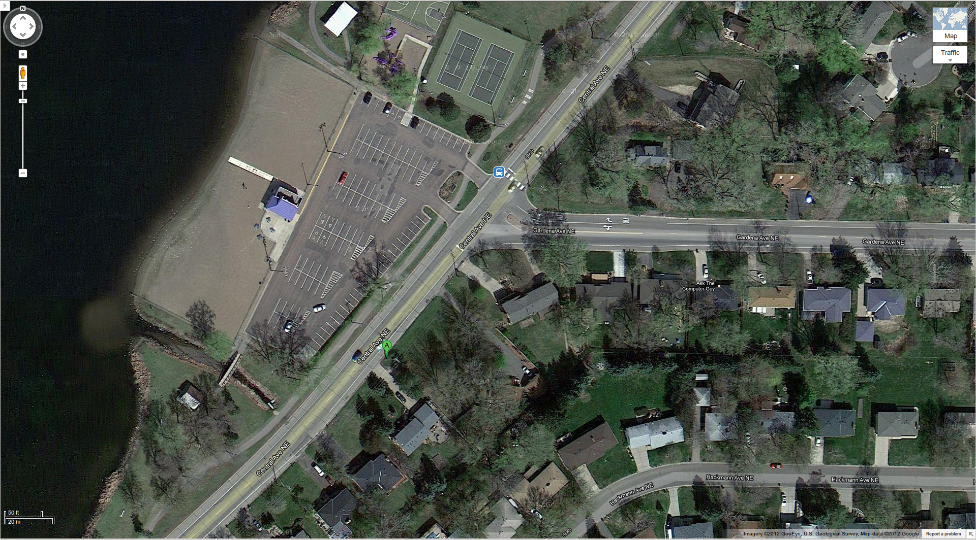
However, my closest bus stop (Central Ave. & Gardena Ave. by Moore Lake Beach) is a pedestrian SNAFU, no thanks in part to Fridley’s city planners.
You’d think that with an elementary school & high school just 2 blocks to the east of this intersection, the city would have provided a safe walking path down to the beach at Moore Lake Park – not the case.
If you are walking down Gardena Ave. (westbound), you must walk in the turn lane before getting to the crosswalk. Not exactly fun if you have a baby in a stroller or if you value your own life.
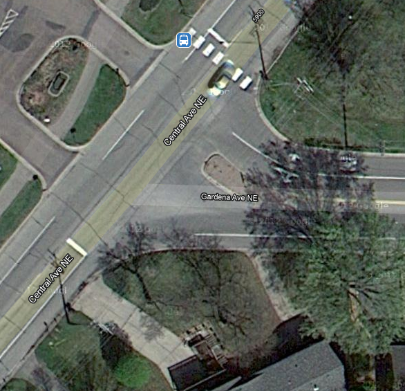
There is an additional problem for 10N passengers if they wish to disembark at this intersection. The northbound 10N’s stop is actually just before Gardena Ave. (map marker “A”). This is actually in a turn lane on Central Ave. for cars going eastbound on Gardena Ave. Pedestrians also wishing to go eastbound on Gardena Ave. can either walk in the yards (no sidewalk is provided) or walk in the turn lane. In the winter, walking in the turn lane is really the only option. Good luck when it’s dark out, it will be like a real-life game of Frogger.
I’m not asking the city to add sidewalks – I don’t think that battle can be won at this time. I’m just asking for pedestrians and cyclist to be given some respect. This intersection has far too much automotive treatment.
Replace right turn lanes with normal shoulder treatment
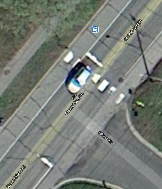
Removing the right turns lanes would solve a lot. Just leave the shoulders painted normally all the way up to the intersection so that cars turning right understand that this is “shared space” and that they are not the priority. A good example of this would be the intersection just to the north at Central Ave. & Hillcrest Dr.:
It’s paint, not rocket surgery
I would remove the right turn lane on Old Central Ave. to Gardena Ave. All you need to do is “erase” the turnout line on the road to reconnect it as a normal shoulder line, and then remove the right turn signs. Residents can put their garbage cans in the street on trash day and pedestrians and cyclists can use the space without fear that they’ll be hit from behind. A side benefit will be that speeding cars will be self-regulated by cars slowing to turn right.
On Gardena Ave. I would also remove the explicit right turn lane and restore normal shoulder painting. Remove the “Straight & Left” arrow from the lane as well and let drivers figure out where they should be going – keeping drivers on their toes will make them more cautious, creating a safer environment for everyone.
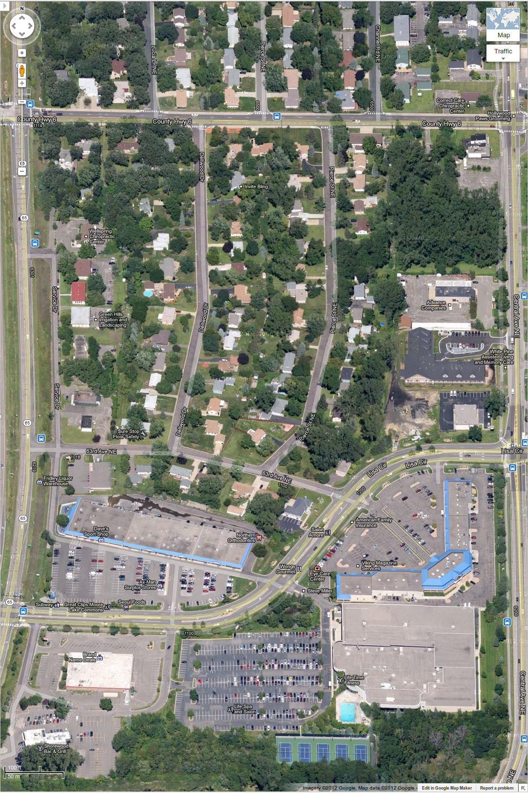
While only a tiny stretch in length (it only spans three blocks), E. Moore Lake Drive has serious girth. This section of road feels strangely disjointed from its bookends. West Moore Lake Drive and Rice Creek Road which extend to the west and east (respectively) are both 2-lane roads, while E. Moore Lake Drive is a 5-lane stretch that badly needs to be put on a road diet to improve safety, and at the same time, capture value.
There are many fine businesses nestled on this tiny stretch of road: Ax-Man Surplus, Dave’s Sport Shop, Fantasy Gifts (for the naughtier bunch :)), an Asian food market, a couple of restaurants, a day care center, a dentist… the list goes on. Fridley, being the “Suburban Hell” that it is, had little (or no) foresight into how people without automobiles would patronize these businesses – they simply assumed that it would never be the case.
You can see E. Moore Lake Drive at the bottom of this image, with its surrounding neighborhood to the north:
East Moore Lake Drive (incorrectly labeled by Google as “Lisa Cir”)
One major issue is with everything on the north side of E. Moore Lake Dr. There is no sidewalk on the north side of the street. It is not uncommon for me to see people walking in the street on the north side of E. Moore Lake Drive — especially between Moore Lake Commons and (Old) Central Ave. (the section marked incorrectly as Lisa Circle). Especially in winter, pedestrians have no other choice than to walk in the street. Did city planners ever imagine that anyone living in this block of land would maybe walk to these businesses?
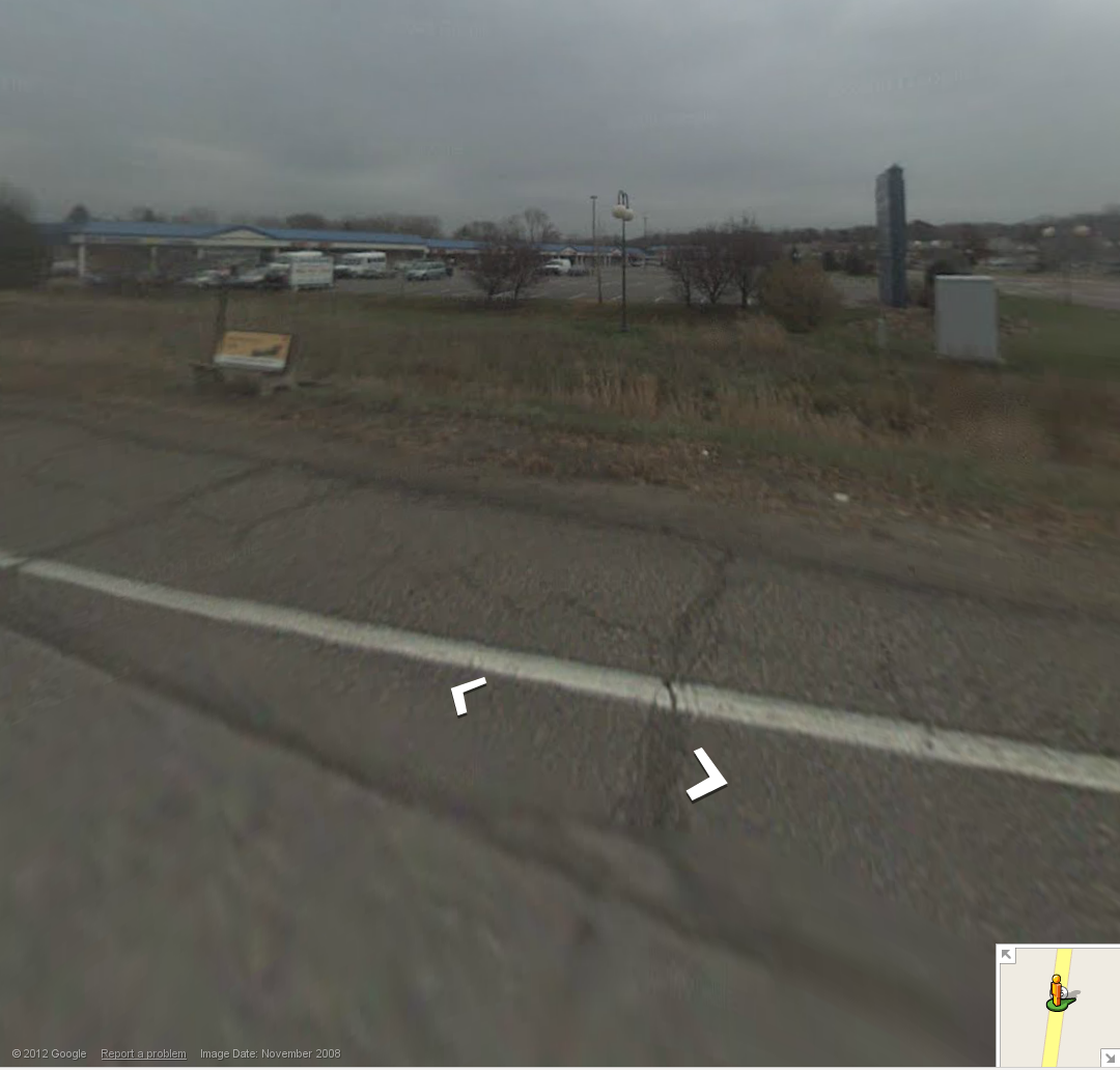
Bus Stop
For commuters, there’s a bus stop bench at the intersection of MN-65 & Moore Lake Drive (lower left blue icon in the above image). From this bench you can easily walk to any of the shops to escape freeway speed traffic, that is if you’re willing to walk through the drainage ditch to get there:
“Bus Stop”
Speed Limit
There’s no posted speed limit on this twisty section of Moore Lake Drive, so it’s confusing if the speed limit is 30MPH as posted on West Moore Lake Drive, or if it’s 35MPH as posted on Rice Creek Rd. after Moore Like Drive intersects (Old) Central Ave. Drivers often opt to go with the higher figure, which really becomes 40MPH.
There are no crosswalks on this stretch. Would you feel safe crossing a twisty 5-lane road with low visibility where there are no crosswalks and the cars are traveling at 40MPH? Why this road is so wide is beyond me. For what, traffic to Lifetime Fitness and Subway?
Fixes
I would like to say at minimum, there should be a sidewalk on the north side of the street. But sidewalks are expensive, and it may take away from precious suburban parking spaces at Moore Lake Commons. So if you’re a penny-pinching city-planner you might just skip to the last paragraph about road diets. Paint is cheap!
The parking lots at all of the businesses along E. Moore Lake Drive – Lifetime, Brand Name Deals (now Salvation Army), Moore Lake Commons, Moore Lake Plaza- could be consolidated and reduced, provided there was a safe way to cross the street (crosswalks, less lanes, reduced speed).
For the road diet, E. Moore Lake Drive could be re-painted as a two lane road, but retain the turn lanes at the intersections. If you got rid of some of the parking lot area, you could allow on-street parking to make up for lost spaces. Add a bike lane and now it seems much more friendly for all modes of travel.